• Added a full-screen gallery viewer for Wikimedia images
• Introduced a new plugin "Vehicle Metrics" to monitor vehicle performance using the OBD-II protocol
• Added the ability to assign activities to tracks and filter them accordingly
• Implemented new quick actions for trip recording and touchscreen lock
• Introduced customizable map button appearance and a precise grid
• Added a context menu and a "Reset average speed" action to widgets
• Added new route layer "Dirt Bike trails"
• New "Speedometer" widget compatible with Android Auto
• Configure the map screen by adding multiple "Quick Action" buttons
• Improved readability of data in graphs
• Added filters by sensor data for tracks
• Improved appearance customization for group of tracks
• Added support for additional GPX tags
• Customize "Distance during navigation": choose between precise or round up numbers
• Unified UI for track selection
• OpenStreetMap login switched to OAuth 2.0
Fix crashes
• Android Auto: Added 3D mode
• Tracks: Introduced filters and smart folders, optimized memory for larger files
• Enhanced top and bottom widget panels to accommodate all widgets
• Improved local resource management
• Customizable button mapping for external controllers
• New widgets: "Glide Ratio" and "Sun Position"
• OsmAnd Cloud: Now access deleted files
• Enhanced track coloring in Slope mode with new symmetric gradient
• Resolved issues with transparent status bar
• BLE/ANT+ sensors: reworked connection, writing and viewing received data to GPX
• Free backup for favorites and settings to "OsmAnd Cloud"
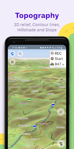
• New format for Terrain maps with 3D Relief support
• Tracks management: updated UI, added sorting, support of nested folders
• Android Auto: new start menu for access favorites, tracks and POI categories
• One list of widgets for the Top/Bottom panel
• New "Train" profile, allows to calculate railways routes
• BLE/ANT+ sensors: reworked connection, writing and viewing received data to GPX
• Free backup for favorites and settings to "OsmAnd Cloud"
• New format for Terrain maps with 3D Relief support
• Tracks management: updated UI, added sorting, support of nested folders
• Android Auto: new start menu for access favorites, tracks and POI categories
• One list of widgets for the Top/Bottom panel
• New "Train" profile, allows to calculate railways routes
• Improved "Tracks" menu in "Configure Map"
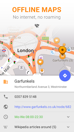
• Context menu now displays localized names for POI
• Added option to share route by link
• Added "Nautical miles/feet" unit of length
• Map orientation added new fixed mode
• Simplified start screen
• Fixed location position in split screen mode in Android Auto
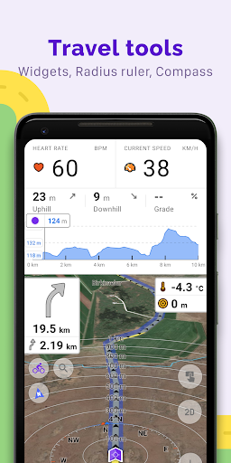
• Added "Speed/Slope" graph for track analysis
• Android 13 moved app language selection to system settings
• Fixed issues with displaying Vegan places
• New, faster Version 2 (OpenGL) map rendering engine, with 2.5D view
• Smooth animation of location changes while in motion
• New widgets for map center coordinates and elevation of geolocations
• "Distance to tap": added text size options
• "Map marker" widget: added option to change click behavior
• Fixed "Display position" option
• GPX: added support for "link", "cmt", "desc" tags and for any custom extensions
• Reorganized "Nautical maps" list
• Added support for ANT+ sensors
• Version 2 (OpenGL) map rendering engine, with 2.5D view
• Smooth animation of location changes while in motion
• New widgets for map center coordinates and elevation of geolocations
• "Distance to tap": added text size options
• "Map marker" widget: added option to change click behavior
• GPX: added support for "link", "cmt", "desc" tags and for any custom extensions
• Reorganized "Nautical maps" list
• Added support for ANT+ sensors
• Added option to disable download UUID
• Widgets redesign: new Look & Feel, group by Pages, change order and combine as you want.
• Hiking / Cycling / Travel routes: tap on the route symbol and get full information about the route.
• Favorite groups: set default appearance for new points in the group
• Fixes: online tile-maps auto-update
• Added initial support for Android Auto
• User interface update for UTM coordinate search
• GPS Filter for GPX Tracks
• Elevation Widget (Pro)
• Favorites: added ability to view recently used icons
• Route planning: will use the selected profile after launch
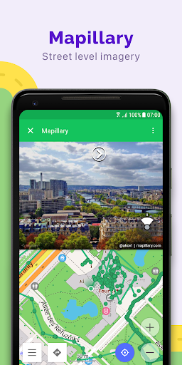
• Fixed Mapillary layer, the plugin is now disabled by default
• Added screen to manage all history in the app
• Map orientation is not reset after restarting the app
• Improved SRTM height marker rendering
• Fixed Arabic map captions
• Added initial support for Android Auto
• User interface update for UTM coordinate search
• GPS Filter for GPX Tracks
• Elevation Widget (Pro)
• Favorites: added ability to view recently used icons
• Route planning: will use the selected profile after launch
• Fixed Mapillary layer, the plugin is now disabled by default
• Added screen to manage all history in the app
• Map orientation is not reset after restarting the app
• Improved SRTM height marker rendering
• Fixed Arabic map captions
• Cloud backup
• Added night mode for "Topo" rendering style
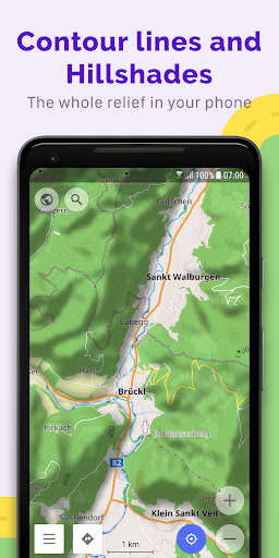
• Added option to download Contour lines in feet
• Tracks can now be colored by altitude, speed, or slope.
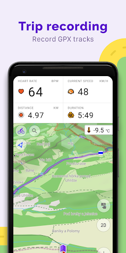
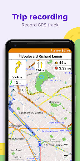
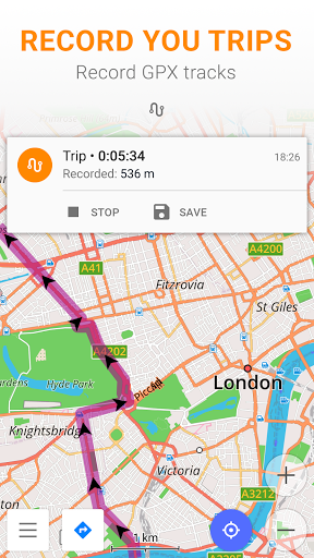
• Updated "Trip recording" dialog
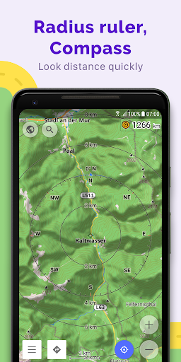
• Distance by tap moved from the Radius ruler into a separate option
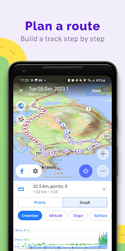
• Plan Route: added ability to change navigation options, accessing configure map and search without leaving plan route
• Added option to change the route line appearance.
• Cloud backup
• Added night mode for "Topo" rendering style
• Added option to download Contour lines in feet
• Tracks can now be colored by altitude, speed, or slope.
• Updated "Trip recording" dialog
• Distance by tap moved from the Radius ruler into a separate option
• Plan Route: added ability to change navigation options, accessing configure map and search without leaving plan route
• Added option to change the route line appearance.
• Added option to export and import all data including settings, resources, my places
• Plan Route: graphs for track segments with route, and added the ability to create and edit multiple track segments
• Added OAuth authentication method for OpenStreetMap, improved UI of OSM dialogs
• Support custom colors for favorites and track waypoints
• Updated "Plan Route" mode allows using different navigation types for each segment and attaches any track to the roads
• New "Appearance" options for tracks: select color, thickness turn on the direction arrows and start/finish marks
• Improved bicycle nodes visibility
• Context menu for tracks with basic info
• Improved "Search" algorithms
• Improved "Follow track" options in Navigation
• Fixed issues with import/export of profile settings
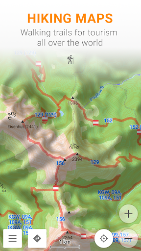
• New offline Slope maps
• Full customization of Favorites and GPX Waypoints – custom colors, icons, shapes
• Customize items order in Context Menu, Configure Map, Drawer
• Wikipedia as a separate layer in Configure map, select only needed languages
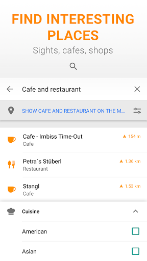
• Create your own POI filter/maps with total flexibility
• Added options to restore settings for custom profiles
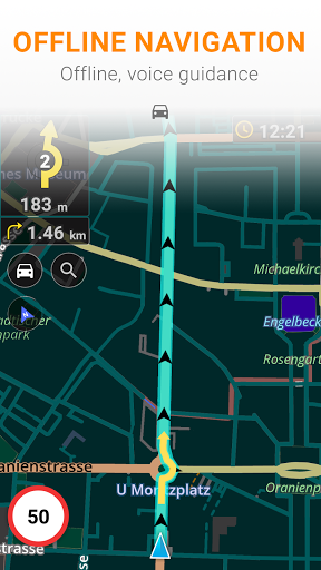
• Full GPX routes from Navigation support traffic lanes and complete turn instructions
• Fix UI sizes on tablets
• Fix bugs with RTL
• New offline Slope maps
• Full customization of Favorites and GPX Waypoints – custom colors, icons, shapes
• Customize items order in Context Menu, Configure Map, Drawer
• Wikipedia as a separate layer in Configure map, select only needed languages
• Create your own POI filter/maps with total flexibility
• Added options to restore settings for custom profiles
• Full GPX routes from Navigation support traffic lanes and complete turn instructions
• Fix UI sizes on tablets
• Fix bugs with RTL
• Profiles: now you can change order, set icon for map, change all setting for base profiles and restore them back to defaults
• Added exit number in the navigation
• Reworked plugin settings
• Reworked Settings screen for quick access to all profiles
• Added option to copy settings from another profile
• Added ability to change an order or hide POI categories in Search
• Correctly aligned POI icons on the map
• Added Sunset / Sunrise data to Configure Map
• Added Home/Work icons on the map
• Updated application and profile Settings. Convenient arrangement of settings by type, ability to customize each profile.
• New map download dialog that suggests a map to download while browsing
• Night theme fixes
• Fixed few routing issues around the world
• Updated basemap with more detailed road network
• Fixed flooded areas around the world
• Ski routing: added height profile and route complexity to the route details
• Application profiles: create a custom profile for your own needs, with a custom icon and color
• Add settings for default and min/max speed for profiles
• Added a widget for the current coordinates
• Added options to show the compass and a radius ruler on the map
• Improved map downloads in the background
• Returned "Turn Screen On" option
• Fixed Wikipedia language selection
• Fixed compass button behavior during navigation
• Bug fixes
• New Directions screen: Displays Home and Work destination buttons, previous route shortcut, list of active tracks, search history
• Additional info under 'Route details': road types, surface, steepness, smoothness
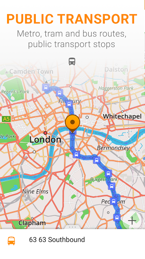
• Public transport navigation
• New Quick action for show/hide tracks and day/night modes
• Fixed flooded areas in Germany, South Africa, Quebec
• Improved import for KML and KMZ import
• Fixed crashes on opening some public transport stops
• Removed Facebook and Firebase analytics
• New Directions screen: Displays Home and Work destination buttons, previous route shortcut, list of active tracks, search history
• Additional info under 'Route details': road types, surface, steepness, smoothness
• Public transport navigation
• New Quick action for show/hide tracks and day/night modes
• Fixed flooded areas in Germany, South Africa, Quebec
• Improved import for KML and KMZ import
• Fixed crashes on opening some public transport stops
• Removed Facebook and Firebase analytics
• Fix subscription settings
• Add more translations
• Fixed crash on startup that occurred on some devices
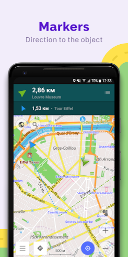
• New Markers feature: display the markers that have already been traversed
• Search history now shows the categories you have searched for previously
• Fixed crash on startup that occurred with non-latin maps
• Improve rendering speed issues on Android 8.0 devices
• Support for the polygon (non-amenity) objects editing
• Measure distance: add Measure button to Actions in the context menu
• Fixed crash on startup that occurred on some devices
• New Markers feature: display the markers that have already been traversed
• Search history now shows the categories you have searched for previously
• Fixed crash on startup that occurred with non-latin maps
• Improve rendering speed issues on Android 8.0 devices
• Support for the polygon (non-amenity) objects editing
• Measure distance: add Measure button to Actions in the context menu
• Fixed crash on startup that occurred with non-latin maps
• Improve rendering speed issues on Android 8.0 devices
• Support for the polygon (non-amenity) objects editing
• Measure distance: add Measure button to Actions in the context menu
• Navigation: Fix progress bar, fast swapping of the start and end point of the route
• Map markers: fix turn on/off groups, ability to hide markers from the map
• OSM Edit: Ability to edit tags for non-point objects and ways, fix missing comments on notes, backup of edits
• Improve Wikipedia and Wikivoyage parsing, updated files are already available
• Context menu: fix transport shields color in the night mode, fix additional menu sizes
• Boat navigation: support for waterway fairway
• New Travel menu: view WikiVoyage articles without using the internet
• Wikipedia: new look, active links, images
• Open Track UI: display waypoint groups
• Map markers: import of selected groups from GPX files, coordinate input new look
• OsmAnd Live subscription now includes all OsmAnd features
• New Travel menu: view WikiVoyage articles without using the internet
• Wikipedia: new look, active links, images
• Open Track UI: display waypoint groups
• Map markers: import of selected groups from GPX files, coordinate input new look
• OsmAnd Live subscription now includes all OsmAnd features
• New Travel menu: view WikiVoyage articles without using the internet
• Wikipedia: new look, active links, images
• Open Track UI: display waypoint groups
• Map markers: import of selected groups from GPX files, coordinate input new look
• OsmAnd Live subscription now includes all OsmAnd features
• Updated the context menu: show when the POI opens / closes• Transport menu: all available routes are now at the top.• Wikipedia: added the button to open the original article, updated the appearance of articles• Route: added possibility to swap start and end points in one tap• Notes: added sorting by type and date• OSM edits: show an icon and a name of the POI category, display completed actions• New quick coordinate input screen for quick markers creation
• Mapillary plugin with street-level imagery• Ruler tool for distance measurement• GPX split intervals with detailed info about your track• Other improvements and bug fixes
• Mapillary plugin with street-level imagery• Ruler tool for distance measurement• GPX split intervals with detailed info about your track• Other improvements and bug fixes
• Mapillary plugin with street-level imagery• Ruler tool for distance measurement• GPX split intervals with detailed info about your track• Other improvements and bug fixes
- Fixed bug with Wikipedia- Cyclemap tiles fix (required to delete tiles folder)- Settings for coordinates format- Other bug fixes
* This is an urgent release to turn off feature of wake lock on display screen during navigation and align with Play guidelines (more fixes will be provided following week)
• Redesigned Direction menu
• Navigation on public transport, support of all kinds of transport: Metro, Buses, Tram and so on.
• Quick action for Show/Hide tracks, day/night mode switches
• Additional support for import of KML and KMZ
• Fix crashes at some public transport stops